Toxic flood risk: All residents should be safe from the harmful effects of industrial pollution and the impacts of climate change.
Insights & Analyses
- Across the US, about 84.4 million people live in areas where at least one hazardous facility is at risk of future flooding. These include refineries, power plants, large animal operations, sewage treatment plants, waste and recycling centers, landfills, incinerators, industrial sites, oil and gas wells, fossil fuel terminals, cleanup sites with radioactive material, and former defense sites. About 13 million of these individuals live in areas where five or more of such facilities are at risk of future flooding.
- West Virginia has the largest share of residents (69 percent) living in areas where at least one hazardous facility is at risk of flooding—about 1.2 million people. In New Jersey, about half of all residents (4.6 million) live in hazardous flood-risk areas. Other states with high levels of hazardous flood risk include Rhode Island (59 percent of residents or 648,000 people), Massachusetts (49 percent of residents or 3.4 million people), and Connecticut (47 percent of residents or 1.7 million people).
- Roughly one in four people in the U.S. live near a hazardous facility that is at risk of flooding. Exposure levels range between 23 percent-28 percent across racial groups, but Latino and Pacific Islander communities face the highest overall exposure (28 percent and 27 percent respectively). Native populations face slightly lower overall risk but there are notable disparities between residents in rural (19 percent) and urban (26 percent) areas. Non-Hispanic White residents show the opposite pattern, with higher rural exposure (27 percent) than urban (24 percent).
- About one in four children, adults, and seniors live near a hazardous facility that is at risk of flooding. Those experiencing economic vulnerability also face increased risk as roughly 28 percent of people living under 150 percent of the federal poverty level live near such areas. Twenty nine percent of households with incomes below $25,000 also live near such areas compared to 24 percent of those with incomes of $150,000 or more.
- Immigrants (27 percent) also experience slightly higher exposure than US-born residents (25 percent), and households facing linguistic isolation, especially those speaking Spanish (33 percent) or Indo-European languages (32 percent), are among the most exposed.
Drivers of Inequity
Due to climate change, communities across the United States face growing risks of flooding. As the glaciers and ice sheets melt, rising sea levels may endanger many coastal areas, and increasingly volatile hurricanes and rainstorms have already led to more frequent, dangerous floods nationwide.
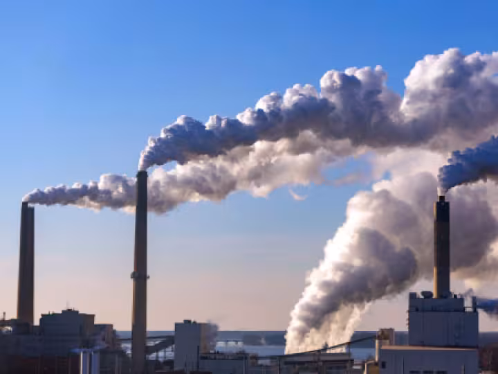
One major flooding risk is water pollution, especially in areas with industrial sites, waste facilities, and other buildings that contain toxic chemicals. People who come into contact with contaminated floodwaters face both immediate and long-term health issues. When industrial facilities flood, they can also release additional pollutants into the air.
While climate change threatens everyone, some communities face far greater risks from toxic flooding. Neighborhoods closest to polluting sites are often low-income and/or communities of color, the result of discriminatory land use policies and development practices that have persisted for generations. These communities must contend with everyday harms like increased air pollution, as well as the acute harms that come with environmental crises like flooding.
Strategies
- At the federal level, secure permanent domestic policy commitments to clean energy infrastructure, decarbonization, green jobs growth; and international commitments to climate accords and other efforts to mitigate the global impact of climate change.
- At the federal, state, and local level, modernize water drainage infrastructure to account for projected changes in flooding risk.
- Employ federal and state grant programs that fund local and/or community-based approaches to flood mitigation.
- At the state and local level, create and maintain crisis response plans that account for the disparate impact of flooding disasters and the needs of people in communities more likely to be impacted, such as health issues preventing evacuation or language needs for public safety messaging.
- Ensure that federal, state, and local emergency responders are properly resourced, trained, and equipped to address the increased flooding risks as a result of climate change.
- Ensure timeliness and accuracy in public messaging around contamination risks in the event of flooding, as many current response systems are slow to notify the public regarding specific risks.
- Strengthen regulatory practices regarding the use, storage, disposal, transportation, and clean up of toxic and hazardous materials; including strict maintenance of sites with hazardous materials and remediation of legacy sites with contaminated soil.
- Require polluting firms to create and maintain comprehensive risk management plans that account for increased risks of extreme weather events due to climate change.
- In communities with increased toxic flooding risk, restore floodplains and other at-risk areas to their natural state, while focusing housing and commercial development in areas with less toxic flooding risk.

Strategy in Action
Pascagoula, Mississippi residents fight for economic justice and environmental preservation. The residents of Pascagoula, a small Gulf Coast city 100 miles east of New Orleans, are no strangers to flooding: the city was devastated during Hurricane Katrina. However, the rising frequency of intense flooding is especially threatening to the Cherokee Forest neighborhood on the city’s eastside. Cherokee Forest residents live next to several toxic sites lining the nearby waterways, including shipbuilding facilities, oil refineries, and an abandoned fertilizer manufacturing plant. Given the dual risk of regular pollution exposure, and water and air contamination during severe flooding, local community members have organized under the banner of Cherokee Concerned Citizens (CCC).
After conducting their own environmental research and analyses, CCC organizers concluded that the necessary strategy was to move their entire community before the next big storm. CCC partnered with Buy-In Community Planning to launch the Relocation to Restoration campaign. Organizers seek a buyout for local residents to resettle, while restoring the neighborhood as a “blue/green buffer”: a natural floodplain area to mitigate toxic flooding risks. Since 2024, CCC has been involved in a novel community-driven planning process with support from a National Fish and Wildlife Foundation grant. Learn more.
Resources
Reports: Sea level rise and flood risk at hazardous facilities in the US; Toxic Tides and Environmental Injustice; Flood maps show US vastly underestimates contamination risk at old industrial sites; When hurricanes hit, flooded industrial sites and chemical releases are a silent, toxic threat; Pollution and Unequal Burdens; What is Environmental Racism?
Data: Sea Level Rise Viewer, Floodings of Coastal Industrial Communities in the US, Coastal Risk Screening Tool